
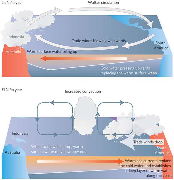
After reaching its peak intensity between December and January, and featuring among the strongest three periods of the past 60 years, alongside those of 1997-1998 and 1982-1983, the current El Niño Southern Oscillation (ENSO) warm phase continued its gradual decline in March, as sea surface temperatures in the equatorial Pacific Ocean declined.
As specialists from the Climate Center of the Cuban Institute of Meteorology have outlined, most forecasting models indicate that this trend should continue during April and May, as sea temperatures return to normal by mid-2016.
In the case of Cuba, the influence of this complex phenomenon, which affects sea temperature and air pressure, saw record temperatures in 2015, the warmest year since 1951, while the period between November 2015 and January 2016 saw above average rainfall, particularly in the western and central regions of the island. Had this not been the case, reservoir levels in both areas would be much lower than they currently are.
However, in February and March of this year, rainfall was much lower than expected.
El Niño had a significant impact in various parts of the world. Argentina, Uruguay and Brazil saw heavy rains and huge floods, while on the other hand, Venezuela, Panama, Indonesia and other nations suffered severe droughts.
For now, most forecasts predict the predominance of neutral conditions in the equatorial Pacific during the second half of the year, however some have indicated the possible development of “La Niña” (the cool phase of the ENSO cycle).


